Environmental Science with Hazards and Disasters BSc (Hons)
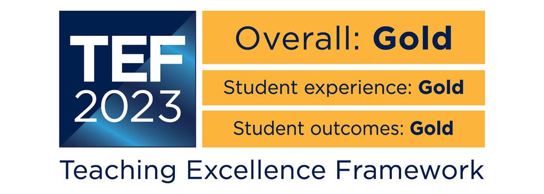
Teaching Excellence Framework (TEF) Gold award
Our commitment to high quality teaching has been recognised with a TEF Gold rating. The University has received an overall rating of Gold, as well as securing a Gold award in the framework's two new student experience and student outcomes categories.
Why choose this course?
What are the causes of earthquakes, volcanoes, tsunamis, hurricanes, floods and landslides? How do we plan for them, lessen their impact and handle the emergencies that can result?
This course examines the physical science of natural hazards, the social factors that can contribute to disasters, emergency planning and disaster risk reduction (DRR). You'll gain expertise in a range of practical and field techniques through ‘real-world' exercises.
Guest speakers come from a variety of DRR organisations, provide first-hand learning opportunities and introduce you to potential career paths.
| Attendance | UCAS code/apply | Year of entry |
|---|---|---|
| 3 years full time | F820 | 20242025 |
| 4 years full time including foundation year | F821 | 20242025 |
| 4 years full time including sandwich year | F822 | 20242025 |
| 6 years part time | Apply direct to the University | 20242025 |
| Main location | Penrhyn Road |
Reasons to choose Kingston University
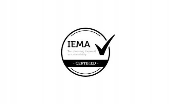
- This course is accredited by the Institute of Environmental Management and Assessment (IEMA).
- The subject is brought to life through UK and overseas fieldwork at locations susceptible to hazards such as earthquakes, volcanoes, landslides and coastal flooding.
- The course is highly practical and you'll work alongside hazard practitioners in fields such as floods and volcanoes.
- There's the opportunity for a year's paid work placement. This will give you valuable experience and help prepare you for a career in an environmental or hazards-related role.
- Our careers team offers a programme of events and training sessions which will help you make the best of your career choices.
- 100% of students thought staff were good at explaining things and felt the course has developed the skills they need for the future (NSS 2023).
Accreditation
This course is accredited by the Institute of Environmental Management and Assessment (IEMA). IEMA is the professional body for everyone working in environment and sustainability. This course entitles students to FREE student membership for the duration of the course and on successful completion you qualify for GradIEMA. Graduate membership is a launchpad for future leaders within environment and sustainability and offers a range of benefits to support you throughout your career. You can then "Fast track" to Practitioner Membership.
The degree apprenticeship route is accredited by the IEMA.
What you will study
As a pathway of the Environmental Science BSc (Hons), the Hazards and Disasters pathway focuses on the key themes of natural hazard science, disaster management and emergency planning.
Year 1
Year 2
Optional sandwich year
Final year
Year 1 provides a broad understanding of earth sciences, the environment and natural hazards. You'll study the building blocks of the environmental science including geology and hydrological, atmospheric and ecological systems. You'll also study modules in Geographical Information Science (GIS) and explore a variety of research and fieldwork methods.
Core modules
Our Dynamic Earth
30 credits
This module introduces key fundamental topics in physical geography, overviewing the various spheres of the Earth, associated processes and interaction. Themes are presented systematically as a cross-section of the Earth's physical structure: geological underpinning, Earth surface processes (introducing geomorphology, the pedosphere and hydrosphere), the atmosphere, and the biosphere.
Interwoven within these topics are lectures on associated environmental hazards, including geophysical hazards (e.g., volcanic eruptions, earthquakes and tsunamis), atmospheric hazards (including hurricanes and tornadoes) and environmental and ecological hazards (including oil spills, and wildfires).
Processes behind these major natural and man-made environmental hazards will be described, with reasons provided for their occurrence and global spatial distribution. Detailed case studies from a variety of geographical regions will help to build a portfolio of examples, enhancing student knowledge of the processes, impacts and means of forecasting and mitigating against hazards becoming disasters.
The module introduces students to the application of environmental and geophysical knowledge and skills to real world challenges and potential discipline-related employment opportunities.
Introduction to Environmental Science
30 credits
This module introduces the basic principles of environmental science, including environmental chemistry, water quality analysis/assessment, environmental pollution, and ecology. The module will investigate basic environmental principles to help students understand how physical and human processes can promote change in environmental systems at a range of spatial and temporal scales.
Students will investigate the impacts of environmental change, understand their significance, and show how this knowledge can be applied to the management of environmental challenges. The importance of a holistic approach to problem solving in the environmental sciences will be introduced along with material on key underpinning scientific disciplines including environmental chemistry and ecology through the investigation of global habitats.
Digital Mapping
15 credits
Maps are tools for visualising spatial information to communicate pattern, processes, and the results of geographical analysis. This module explores the principles and practice of map design and production using Geographical Information System (GIS) software. GIS are introduced, including representations of reality, data types, data management, data quality, and simple analytical operations.
The cartographic design process will be explained including graphic design principles and different modes of delivery (hardcopy/web map/3D) and contrasted to ‘traditional' manual map-making. Legal and ethical issues relating to copyright and attribution of data and media are explained.
Research and Fieldwork Methods
15 credits
This module introduces students to a range of research methods that form the basis of successful investigations in their subject discipline areas, including research design, qualitative and quantitative data collection, and analysis interpretation.
The module, importantly, also introduces fieldwork as a key investigative element of both environmental and geographical study, and the module incorporates the core Level 4 fieldwork, developing both generic fieldwork skills (e.g., pre-field trip reconnaissance using a range of secondary data sources and remote sensing, field safety risk assessments, safety in the field, and ethical considerations) and discipline specific site investigations (e.g., field observations, triangulation for map location and geometrical data collection using compass-clinometers, surveying techniques and GPS location, water quality surveys, analyses of archival data, and questionnaires and interviews).
Developing Academic Skills
15 credits
Students are introduced to their course learning aims and consider their anticipated learning targets from induction to graduation. Students are guided to identify and take ownership of their personal academic journey through the development and application of academic skills aligned to KU Graduate Attributes and their discipline-specific professional body learning outcomes.
Students are tutored in a range of learning to learn techniques and are introduced to assessment for learning and the role of feedback, reflection and feedforward as an integrated part of their learning journey. This will be supported through active engagement in the KU Navigate Programme enabling students to understand and begin to develop a design thinking approach to Future Skills development.
Sustainability for Professional Practice
15 credits
This module will explore the global environmental, economic, and social problems that society faces and encourage students to find and create sustainable innovative solutions.
The students will be introduced to the complex societal problems and current challenges associated with social justice, cultural inequalities, ethics, and climate change emergencies, this will enable them to reflect on the UN Guiding Principles on Business and Human Rights. The students will be immersed in a culture of education that provides knowledge, values, attitudes, and skills and encourages them to think about possible solutions seeking to balance economic, environmental, and social objectives set by the United Nations Sustainable Development Goals (UNSDGs), and the challenges in achieving those goals.
Students will be able to develop knowledge, values, attitudes, and skills associated with systems thinking and integrated problem-solving within the context of environmental systems and processes and the built environment. This will encourage students to critically address ways to mitigate and solve complex global societal problems addressed by the UNSDGs.
Working in teams, students will explore, and debate: to evaluate the interconnectivity between the United Nations Sustainable Development Goals (UNSDGs), collaborate and co-design practical and equitable strategic solutions to Net Zero carbon (positive), and evaluate sustainability-related global challenges (e.g., the climate emergency) while developing critical thinking and self-awareness
Year 2 develops the theory and practice of disaster risk reduction. You'll enhance your knowledge of GIS, geomorphology, atmospheric science, tectonic hazards, climate-driven hazards such as flooding and a range of hazard mitigation and adaptation strategies. An overseas trip will provide the opportunity to develop your fieldwork skills.
Core modules
Disasters, Society and Culture
30 credits
This Level 5 module introduces the key theories and concepts in the social science approaches to understanding disasters, one of the major global challenges facing humanity. It explores the social, cultural, political, economic and other factors that combine to construct vulnerabilities to disasters, and the ways in which these might be countered through Disaster Risk Reduction (DRR) strategies. These issues are explored at a range of spatial scales, from the local to the global, along with the inter-linkages and process that bind them together.
The relationship between evolving theories and practice are explored through a number of case studies which consider developed and developing world examples across a variety of hazard types. The challenges posed by the interdisciplinary approaches that are necessary to tackle disasters, and the need to communicate with a wide range of stakeholders, are examined. The complex range of factors influencing DRR implementation in particular contexts, and the variety of skills needed to evaluate DRR are investigated through fieldwork.
The fieldwork will also provide an opportunity for students to gain an understanding of the processes involved in developing a research proposal. Employability skills and the transferability of acquired knowledge to the workplace environment are introduced and developed.
Rivers, Oceans and the Atmosphere
30 credits
This module explores the physical science of Earth's hydrosphere and the atmosphere, key processes and principles, and associated hazards. Through a sculpted narrative, the module curriculum will take students on an investigative journey to explore land, ocean and atmosphere environments and their interactions, with a persistent focus on the impact of climate change on these systems.
The narrative will follow the water cycle, starting with precipitation on land and a study of drainage basins, followed by investigations of rivers, estuaries and coasts, then on to the ocean and ocean circulation, and finally the atmosphere. Hydrological and sedimentological processes will be considered, following a source to sink approach.
A variety of hydrospheric and atmospheric hazards will be considered throughout the module, including riverine and coastal flooding, sea-level rise, and severe weather hazards associated with ENSO, the Indian Ocean Dipole and the SE Asian Monsoon System. Fieldwork, GIS and remote sensing practicals will be integral to this module, providing real-world skills and training relevant to a wide variety of environmental science, hazards and geography careers.
Geomorphology, Geotechnics and Geohazards
15 credits
This module presents a series of thematic taught sessions overviewing major geomorphological processes and landforms, sedimentary environments and potential hazards associated with these environments. Students will investigate a diverse range of geomorphological environments encapsulating a variety of continental and tectonic terranes and coastal landscapes. Module curricula will explore geomorphological features fundamental to these various environments and consider the geological and geomorphological processes that shape these landscapes.
Geomorphological change will be considered for the various landscapes and, in concordance, students will explore how climate change is impacting the various environments, in what way this affects populations living in these areas, and how the risk can be managed. On completion, students will gain a detailed understanding of the major surface processes and their geomorphological significance and will be able to interpret a range of geomorphological landscapes.
The module emphasises the mastery of geomorphological skills through experiential learning closely associated to core lecture delivery. The practical programme will aid students in evaluating key geomorphological concepts, learning and testing analytical techniques. The fieldwork programme provides an arena for applying new skills and knowledge gained and provides a learning bridge to students wishing to pursue physical geographical and/or hazards-based research projects at Level 6.
Advanced Research Methods
30 credits
Students design, manage and execute an environmental science or environmental hazards research project in a ‘real-life' field-based setting. Students will be trained in quantitative and qualitative data analysis. Therefore, students will learn how to collect, manipulate and interpret statistical environmental data, and apply this learning to their project-based investigations.
Understanding our World with GIS
15 credits
With the increasing focus on data science and big data, data literacy and the ability to develop and implement analytical workflows have become essential transferrable skills. This module is concerned with how to obtain, process, integrate, analyse, visualise, and analyse geographical data within GIS software to discover and quantify spatial patterns. It offers the means to critically evaluate data, analytical approaches, and the outcomes in relation to the principles of information and cartographic design.
The principles and methods of digital data collection and post-processing are introduced (e.g., GPS, mobile apps, aerial and space-based survey, secondary data, APIs). Students will learn how to apply exploratory and basic analytical techniques (e.g., buffer, spatial join, overlay, surface and network analysis) to discover pattern. They are introduced to and gain practical experience of the relational database, and network and surface data models and their analytical use.
Project Management
15 credits
The optional sandwich year between Years 2 and 3 includes a work placement or international exchange. The work placement gives an opportunity for paid work and valuable experience in an environmental or hazards-related field. We will keep in touch with you throughout your placement, ensuring the skills and training you receive translate effectively into your studies and career aspirations.
The modules in Year 3 further develop your knowledge of disaster management, with an emphasis on recent case studies. You'll also research and engage with practising professionals in all areas of disaster management.
Core modules
Research Project
30 credits
This module provides students with experiences in the design, preparation and execution of an independent and supervised programme of research.
The module guides students to employ reflective learning techniques and to develop a variety of level-appropriate employability skills by engaging with their research project as academic research with commercial, policy or political value which requires effective dissemination and communication to a range of suitable audiences. Employability skills developments are integral to the Research Project module.
The specific nature of the research project chosen allows the students to target specific skills they wish to develop in their learning pathway and the project supervisors will work closely with the students to identify and articulate these skills and relate these to Future Skills.
The Science of Climate Change
15 credits
This module explores the science of climate change through an in-depth exploration of the components of the climate system and an examination of climate change indicators such as sea-level change and ocean acidification. The influence of human activities that contribute to climate change, such as greenhouse gas emissions and deforestation will be explored and future climate models and scenarios will be evaluated.
The module will highlight how recent climate change is predominantly due to anthropogenic forcing rather than natural climate drivers. Students will learn to critically evaluate and discuss models of future climate change and will produce their own climate projections for the UK based on real data.
The fieldwork programme will also provide students with an opportunity to enhance their understanding of climate change by seeing examples of past climate change in the local palaeo and geomorphic record. Examination of the palaeo record of past climate change will give context to the evaluation of future projected climate change scenarios.
Disaster Management
15 credits
This module takes a critical approach to disaster management (DM) and its implementation. The focus is largely based on the UK where the term used is emergency management (EM) but there is some consideration of disaster management beyond these boundaries.
The module examines the varying ways in which society attempts to reduce the impacts of hazards through disaster management, providing an exploration of how the historical, geographical, social, economic and political contexts shape its creation and implementation. The complex division of responsibilities and the wide range of stakeholders involved in emergency management in the UK are explored. The challenges of coordination and communication in this system are considered and evaluated.
The module develops a range of employability skills to prepare students for employment in environmental hazards and disaster management careers. This includes interaction with practitioners and the evaluation of the effectiveness of existing strategies and practices to deliver EM and communicate with stakeholders.
Geophysical Hazards: Processes and Disaster Risk Reduction
15 credits
This module presents a series of thematic taught sessions (classroom and field-based) overviewing geophysical hazards, accompanying impacts, and how risk can be limited through disaster risk reduction methods. In studying earthquakes, volcanoes and tsunamis, module curricula will provide a detailed exploration of the scientific processes underpinning these hazards; e.g., students will learn how magma geochemistry, texture and transport history are fundamental to the resulting style of volcanism (e.g., effusive or explosive), and how all these characteristics can be tied to the tectonic and/or geological setting of a volcano.
Through gaining a more detailed understanding of the scientific processes and mechanisms that drive the various geophysical hazards, students are provided with the knowledge base required to record evidence of past geophysical events for a given location. The fieldwork programme will provide the students with the opportunity to learn how this knowledge can be utilised to produce risk maps and investigate the most up-to-date methods in which risk associated with these hazards can be measured and reduced through a variety of engineering solutions and disaster management.
Applying Professional Skills
15 credits
Students will demonstrate the ability to apply their developing professional skills competencies in their chosen area and will ensure they have a broad understanding of the business environment in which professional activities are undertaken. The module will develop the student's technical, management and interpersonal skills required to perform in a team environment and prepare the students for employment and entrepreneurship.
Students will participate in Kingston University's Bright Ideas competition where they will work together as a team to develop a business idea of their choice. To do this they will need to interact with relevant stakeholders outside the University.
Students will be guided to interact with professional and learning communities beyond the university and reflect on these interactions. This may include participation in co-curricular events such as subject-specific and career development events (e.g. talks, workshops, speed interviews), networking opportunities offered by the subject-specific professional bodies, exploring pathways to professional chartership/membership, leveraging interactions with professionals in the development of the final year research project and, reflecting on the co-benefits of these interactions.
Solving Real World Data with GIS
15 credits
This module offers in-depth knowledge as well as hands-on skills for a series of spatial analytical and modelling approaches that can be used for solving real-world problems.
At the heart of this module will be the notion of spatial understanding of data science. This relates to the fundamental notion in geography and environmental science whereby spatial patterns and spatial inequity are rife in the real world (e.g., high property price in accessible and branded areas; persistence of crime hotspots; specific ecological habitats that exist for particular species; regions prone to a specific natural hazard such as hurricanes).
Offering solutions to these various challenges require a systematic and quantitative appreciation as well as suitable interpretation of the data, and this module is designed to offer the means to achieve this through a series of spatial analytical and spatial statistical methods, including point pattern analysis, spatial interpolation and spatial regression.
Foundation year
If you would like to study one of our science degrees at Kingston University but are not yet ready to join the first year of a BSc(Hons) course, you can include an extra foundation year within your chosen degree. Please see the science foundation year course page for details of modules.
Future Skills
Knowledge to give you the edge
Embedded within every course curriculum and throughout the whole Kingston experience, Future Skills will play a role in shaping you to become a future-proof graduate, providing you with the skills most valued by employers such as problem-solving, digital competency, and adaptability.
As you progress through your degree, you'll learn to navigate, explore and apply these graduate skills, learning to demonstrate and articulate to employers how future skills give you the edge.
At Kingston University, we're not just keeping up with change, we're creating it.

Entry requirements
Teaching and assessment
Teaching includes lectures, seminars and tutorials, practical classes and integrated fieldwork study. We place an emphasis is on learning through experiences and there is field and practical work at all stages, including local and overseas fieldwork.
Assessment is varied and your assignments may replicate tasks you are likely to face in the workplace including report writing, role-playing exercises, presentations and environmental hazards and disaster management project exercises.
Staff teaching on this course
The course is taught by the Department of Geography, Geology and the Environment. Staff have a wide range of experience across research and industry and continue to practice and research at the cutting edge of their discipline. This ensures that our courses are current and industry informed ensuring you get the most relevant and up-to-date education possible.
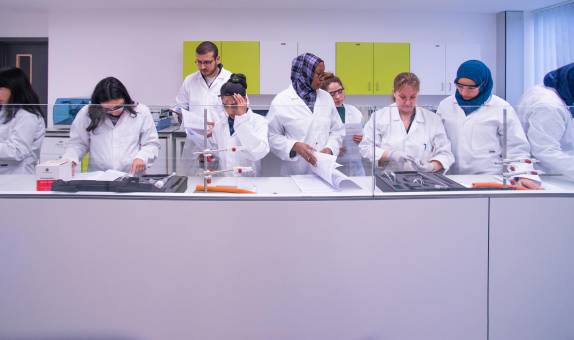
The Department has invested substantially in the development of laboratories for teaching and research into subjects such as environmental monitoring, geology, geochemistry, mapping / GIS / computing facilities, and specialist instrumentation laboratories (e.g. nuclear metrology, laser Raman spectroscopy, 3D mapping).
Postgraduate students may run or assist in lab sessions and may also contribute to the teaching of seminars under the supervision of the module leader.


Facilities
There is a wide range of facilities for practical work at our Penrhyn Road campus, where this course is based. You will have access to a modern environment with the latest equipment, including:
- laboratories dedicated to environmental science learning and research
- the £9.8 million Eadweard Muybridge building with state-of-the-art laboratories
- computing laboratories and a team of IT technicians to offer assistance
- the award-winning Town House, with a well-stocked library that boasts an impressive collection of texts, journals and online e-books/journals
- excellent social spaces, plus a large, fully-equipped gym and fitness centre
- a fully-integrated virtual learning environment (Canvas) so you can learn and interact with others on your course 24/7
Course fees and funding
Additional costs
Depending on the programme of study, there may be extra costs that are not covered by tuition fees which students will need to consider when planning their studies. Tuition fees cover the cost of your teaching, assessment and operating University facilities such as the library, access to shared IT equipment and other support services. Accommodation and living costs are not included in our fees.
Where a course has additional expenses, we make every effort to highlight them. These may include optional field trips, materials (e.g. art, design, engineering), security checks such as DBS, uniforms, specialist clothing or professional memberships.
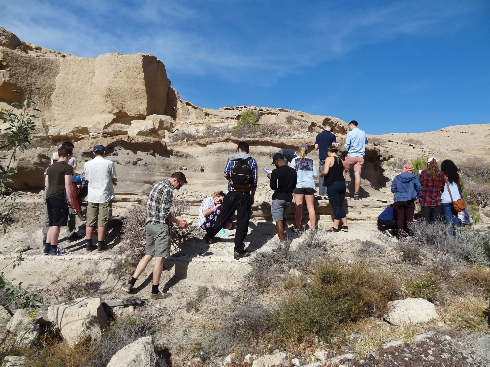
Field trips for this course
Fieldwork is an important part of our environmental science with hazards and disaster management teaching. It deepens your understanding and brings the subject to life.
Below are examples of the main residential trips we run. During Years 2 and 3, many of the modules also include other trips and excursions. You might visit:
- Folkestone Warren on the Kent coast, where you will investigate landslide and coastal erosion hazards and risks
- Ashtead Common, a national nature reserve, close to Kingston
- The nearby North Downs
- The Sussex coast
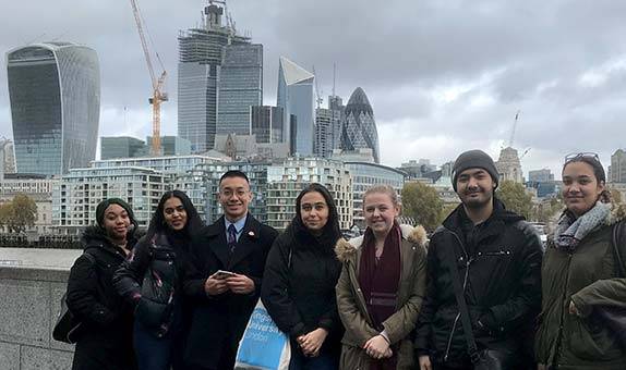
- The River Thames in central London and local streams such as the Hogsmill River
- The Thames Estuary, Rochester and the Medway Estuary and Northey Island in the Blackwater Estuary. You may for example investigate current and future flood risk and the adaptation and mitigation strategies that can increase climate resilience
- The River Thames floodplain
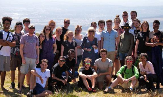
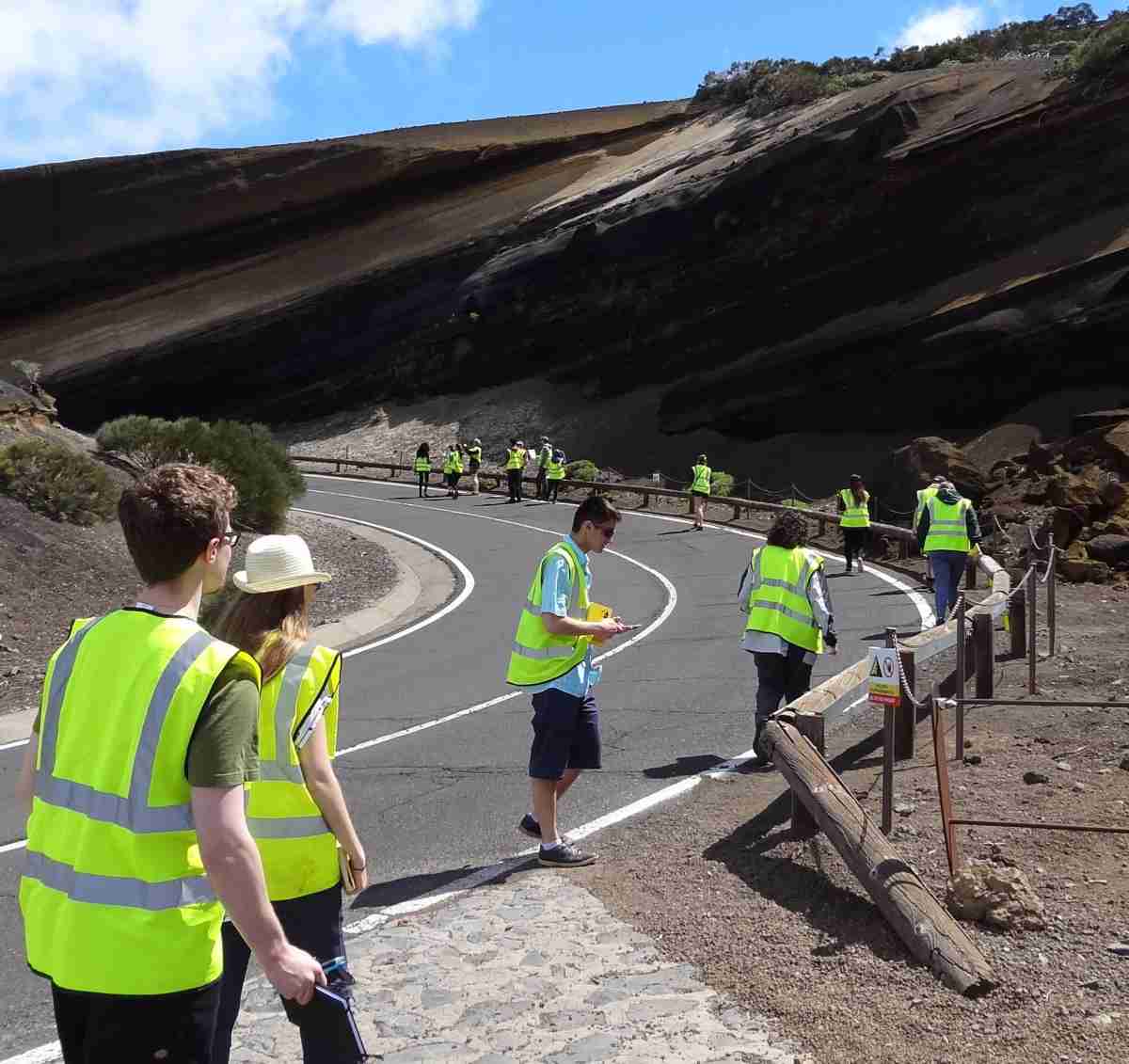
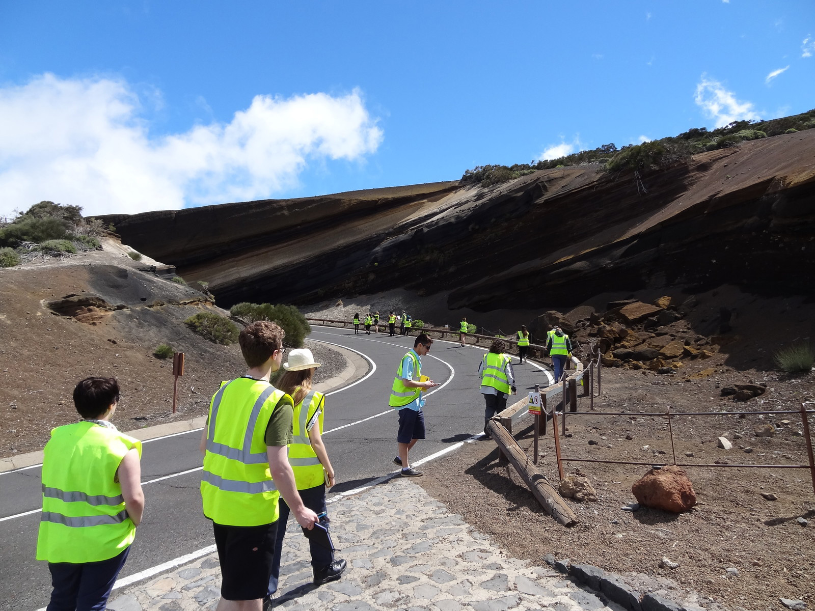
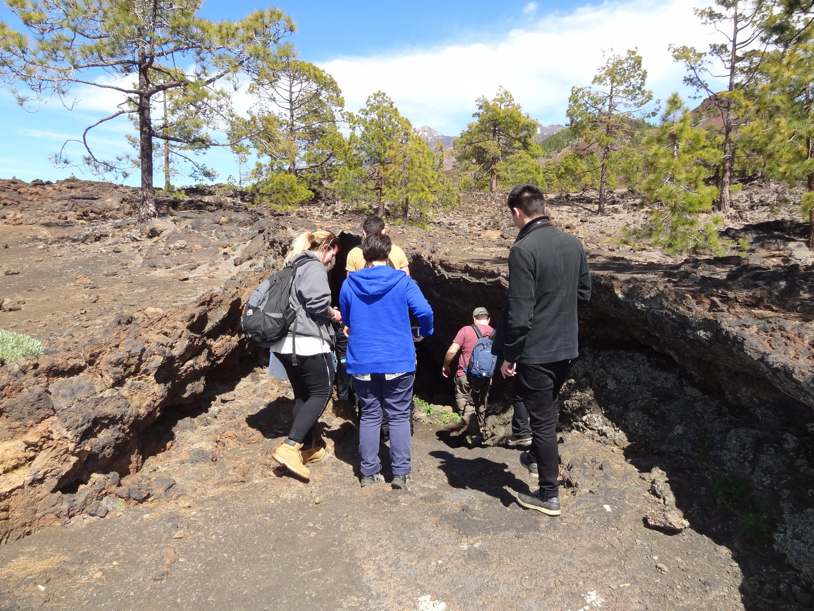
View our image gallery below for an idea of what your fieldwork might involve.
Year 1: Southern UK Based
In the first year you will do a UK based week long trip to an area such as Dorset. Here you will:
- learn and develop a variety of environmental fieldwork skills
- consider the ways in which we collect and analyse data to understand social and environmental issues
- study a range of topics, such as water resources, tourism and natural capital, coastal hazards and climate change
- complete work suggested by lectures and individual projects
- research controversial environmental issues.
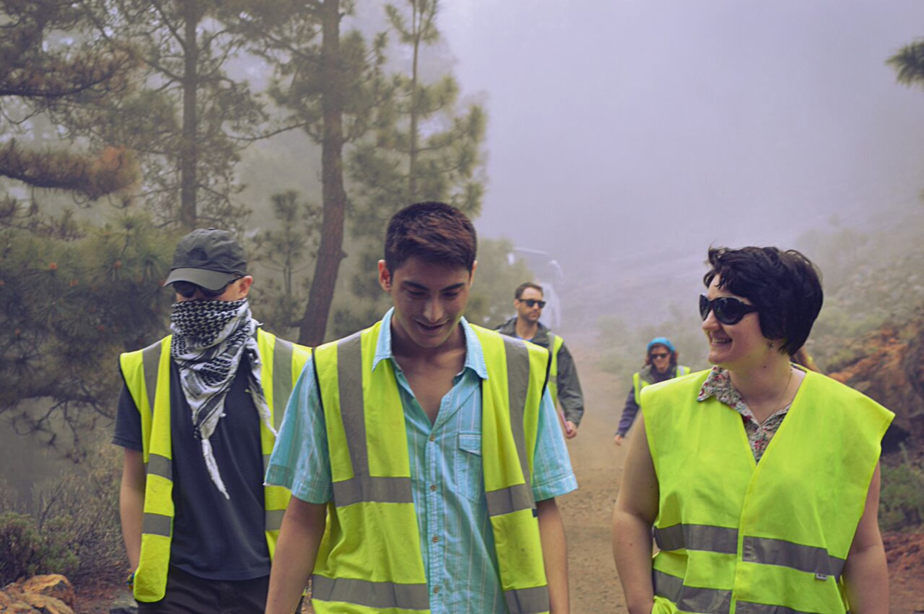
Year 2: European based
In Year 2, you will participate in an overseas field trip to a location such as Tenerife. This gives you the chance to study an environment very different to that of the UK. The Tenerife environment is incredibly diverse, with huge contrasts in climate, soil types and ecology. Here students focus on hazards and disaster risk management as understood and approached from a range of stakeholder perspectives.
Year 3: UK based
In Year 3, students have opportunities to engage in optional fieldwork overseas during the summer. This is part funded by the Turing Scheme (UK government programme) and by the university. Recent summer fieldwork destinations include Almeria in Spain, Bandung in Indonesia and Chesapeake Bay in the USA.

We also have links with international organisations. These include:
- The University of Malta
- Malta Environment and Planning Authority
- Malta Council for Economic and Social Development
- The BREEDE Skills Training Centre and Youth Activity Centre, South Africa
- Naturally Knysna, South Africa
- Backsberg Vineyard, South Africa
International fieldwork programmes enable students to examine human and physical issues in diverse contexts and to get perspective on the challenges that other countries face from local governmental and non-governmental organisations and from industry.
After you graduate
Graduates pursue careers in a variety of commercial, industrial and public sector organisations such as local governments, INGOs, first responders (such as the police and fire service), civil defence, insurance companies and environment consultants.
What our students say
How we work with external organisations
We have good links with employers at Kingston University. This course was set up in response to the growing need for emergency planners, both in the UK and globally.
Throughout your degree we encourage you to think about how to apply your studies to potential real-life work situations. This ensures that you graduate with the skills employers need.
Guest speakers
One way we keep the course up to date is by inviting guest lecturers from the many organisations with which we have contact, including:
- the London Ambulance Service;
- the Metropolitan Police;
- the Fire Service; and
- the Environment Agency.
Many of the guest speakers discuss case studies of actual disasters, such as the Boxing Day Tsunami in 2004 and Hurricane Katrina in 2005. You will also work with hazard practitioners in fields such as floods and volcanoes.
Work placement year
How you can work in industry during your course
Placements:
- provide work experience that is relevant to your course and future career
- improve your chances of graduating with a higher-grade degree
- enhance your CV
- lead to a graduate job
- enable you to earn a year's salary whilst studying (the vast majority of placements are paid)
- help you to select your final-year project.
"To be successful, tomorrow's leaders will need to be far more rounded individuals than ever before. They will collaborate in pursuit of shared goals. They will guide, challenge and support...They will have an appetite for change and a hunger for continuous improvement, and they will have an ethos of learning and development..." Jeremy Darroch, Former Chief Executive, Sky.
"Doing a placement year effectively gives you one foot in the door of a future job and to stand out from the crowd... as well as enhancing my CV... and future interviews. It's a great motivator to be successful in my studies as it only serves to open even more doors and gain more skills." Placement student at Jagex Games Studios Ltd.
There is a lot of support available for students looking to secure a placement (e.g. a jobs board with placement vacancies, help with writing CVs and mock interviews). Getting a placement and passing the placement year are ultimately the student's responsibility.
Examples of placements
Placements can be with large multinational companies, international companies, local companies and small start-ups; offering a diverse range of posts. Here are some examples of employers and roles:
| Construction-based placement employers | Construction-based placement roles |
|---|---|
| RG Group Multiplex Costain Willmott Dixon Fluor |
Assistant site manager Assistant trades package manager Assistant logistics manager Health and safety officer Construction engineer |
| Science-based placement employers | Science-based placement roles |
| Reckitt and Benckiser GSK Drug Control Centre Minton Treharne and Davies Ltd Various local and international hospitals |
Bioanalytical sciences Lab assistant Pharmacy assistant Sports coach |
| Engineering-based placement employers | Engineering-based placement roles |
| Airbus BAM Nuttall Nissan Bosch Wozair |
Analysis of aircraft structure Construction resources specialist Site engineer assistant |
| Computing and IS-based placement employers | Computing and IS-based placement roles |
| Disney Sony Interactive Entertainment Europe IBM McKinsey Intel |
Database coordinator Software developer Website developer App developer |
| Mathematics-based placement employers | Mathematics-based placement roles |
| Lloyds Banking Group AXA Allianz PAU Education, Spain |
Analyst Investment solutions Research analyst Accounts assistant |
Key information set
The scrolling banner(s) below display some key factual data about this course (including different course combinations or delivery modes of this course where relevant).
Course changes and regulations
The information on this page reflects the currently intended course structure and module details. To improve your student experience and the quality of your degree, we may review and change the material information of this course. Course changes explained.
Programme Specifications for the course are published ahead of each academic year.
Regulations governing this course can be found on our website.