Exhibition maps out high-tech future
04/10/03
Exhibition maps out high-tech future
 The latest technologies developed to locate and map emergency incident hot spots have been unveiled at a major exhibition run in association with Kingston University. Visitors from around the globe attended the GeoSolutions 2003 event at Earls Court last month to participate in a series of Kingston-led workshops.
One of the main attractions was the crime mapping workshop run by staff teaching Geographical Information Systems (GIS). GIS involves the use of information technology to analyse geographical data on the characteristics and distribution of features in the physical and human environment.
Senior Lecturer in GIS, Dr Ken Field explained how mapping can be used to establish patterns of criminal behaviour. “GIS is used to locate and map crime; these maps reveal patterns and incident hot spots,†Dr Field said. “Maps that highlight the locations where crimes occur frequently are invaluable to police in helping them to pool resources and develop more effective crime reduction strategies.â€
Health services could also benefit from recent developments in GIS, Dr Field said. “Ambulance operations rooms can use GIS to plan in advance the quickest route between the hospital and an accident scene. GIS also enables clusters of disease to be identified and provides a way to investigate possible causes,†he said.
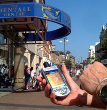
Dr Field explained that public and private sector organisations, multinational companies and environmental groups also routinely used GIS. He believes that the integration of GIS with the Internet, wireless technologies, portable devices and mobile phones is where GIS will develop most significantly in the future. “You can have a geographic information system in a hand-held device which gives you a means of locating yourself in a particular environment,†Dr Field said. “If you want to find a particular road or the nearest bank, GIS gives you that ability. It also has the potential for water companies to locate damaged pipes.â€
Kingston has established an impressive cross-sector reputation teaching GIS and was the first university in Europe to offer a degree in the subject. A Masters degree in Applied GIS has recently been added to Kingston’s portfolio of courses.